Belgium to France - 1859
This is the second in a series of posts that will highlight items from my collection that were sent from Belgium to France.
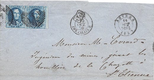
Below is a folded letter from Antwerp (Anvers), Belgium to St Etienne, France - October of 1859.

How It Got There
Markings on the cover:
Anvers Oct 14, 1859 - 9-10 S
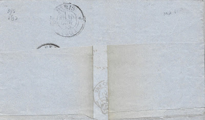
? 1859 (verso)
PD in a box (Paid to Destination)
Belg Amb Calais Oct 15, 1859 - E
Paris Oct 15, 1859 (verso)
Non-local mails between Belgium and France crossed the border at Tourcoing, Quievrain, Erquelinnes, Jeumont, Vireux-Molhain, Givet and Luxembourg. The exchange office markings indicate where the mail was placed in mailbags in Belgium and where they were taken out of those mailbags in France.
Unfortunately, part of the reverse of this cover is missing, so there is evidence of a partial Belgian marking that owuld have given us the Belgian exchange office. The French exchange office was the mail car (traveling post office) on the train to Calais (Amb Calais). This leads me to the assumption that this item crossed the border at Tourcoing.
Also, since St Etienne is south of Lyon, there is likely at least one more French marking after the Paris postmark that is missing from the cover. Typically, there would at least be a receiving date at St Etienne.
With origins such as Antwerp (Anvers) and Brussells (Bruxelles) the routing will have more to do with railway schedules and how the Belgian and French trains link up than it has to do with location. There is additional information in both postmarks in front that have the potential for further decoding. The "9-10S" in the Anvers marking indicate a time of day that would correspond with a train departure. The "E" in the Calais marking, if I recall correctly, would correspond to a sorting crew. If a person could locate train schedules, it is possible the route could be determined.

How Much Did It Cost to Mail?
As of April 1, 1858, a flat rate of 40 centimes per 10 grams was established for prepaid mail from Belgium to France regardless of distance. This rate was effective until December 31, 1865 after which the rate was reduced to 30 centimes. If an item were sent unpaid, the cost would be 60 centimes to the recipient.
The only markings that are related to the payment of the postage are the obliterating cancels on the postage stamps and the "PD" in a box.
The obliterating cancels are a round circle of bars with a "4" in the center. Many European countries assigned numerals in canceling devices to particular offices or towns/cities. The "4" was assigned to Antwerp. Typically, postage stamps were canceled at the location where the item entered the mails. Obliterators were used, in a large part, to prevent the re-use of stamps to pay for the postage on another piece of mail. It is also possible that this process was used as a recognition that the postage was recognized and credited.
The "PD" represents "payée à destiné," which translates to "paid to destination."
Who Was This To?
As a person who sometimes looks at his, or other person's writing, from even a day or two prior and wonders "what does this say?" it is not so hard to understand why this might be difficult for me to read.
Apparently, this is to a Mr. Evrard. I am not certain what the additonal "M_" might indicate.
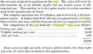
The rest of the address may read something like: "fugeniem des mines, gernus les houiller de la Chazotte." Mr. Evrard must have had something to do with the Chazotte coal mine. A quick search resulted in finding the following scan from a document from 1843. I do not own this item (nor will I, given the price).

This article just might provide an excellent rabbit hole regarding mining in the St Etienne region. And, if you want to read about the formation of coal beds, including the one for the Chazotte mine, you can go here.
M. Evrard is mentioned in this document reporting on the Paris Universal Exposition. Relevant text is below. You can click on the images to view them.


In any event, the addressee appears to be someone of prominence regarding these coal mines. There is no content to add to this story, so we'll just leave it at this.
The mining region (the Loire) is shown in the map below - taken from the wiki to give an idea as to location.
Open Questions:
Can I get help figuring out the words on the address panel that I was unable to decipher?
Can I decipher an actual route for this item if I can identify rail schedules for 1859?
How far down the mining rabbit hole will I go just because I have this item?


